
DJI EnterpriseSoftware

DJI Terra

Product overview

DJI Terra is professional PC software for planning flights and processing data captured by DJI drones. It brings 2D mapping, 3D models, LiDAR point clouds, multispectral mapping and power line inspection together in one program. Built for surveying, agriculture, construction, energy and mining.

Type
PC software
Operating system
Windows 10 (64-bit) or later
Sign-in
DJI account
Editions
Agriculture, Standard, Flagship, Education

Ask about licensing and setup

  • License edition and term matched to your needs
  • Invoices for companies
  • Device and system compatibility advice
Brochure in Mongolian (PDF)
  • Plan and process in one program: draw the flight mission, then process the captured data in the same place
  • 2D mapping: creates orthomosaics of farmland, orchards and urban areas
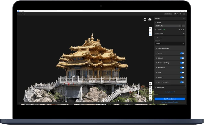
  • 3D modeling: builds 3D mesh models from photos
  • LiDAR point clouds: processes Zenmuse L1, L2 and L3 data into colorized point clouds
  • Multispectral mapping: creates vegetation index and distribution maps
  • Gaussian Splatting: high-quality, true-to-life reconstruction of a scene (Flagship and Education editions)
  • Power line inspection: detailed inspection missions and visible-light modeling of line sections (Flagship edition)
  • Agriculture: creates variable-rate fertilizer and spraying prescription maps and sends them to Agras drones
  • Cluster processing: uses several computers at once to process large datasets fast
  • Measurements and annotations: measure distances, areas and volumes on the map and add annotations
  • RTK/PPK data support: high-accuracy positioning
  • Part of the DJI ecosystem: works with DJI Pilot 2 and FlightHub 2

Brochure in Mongolian

Specifications and features translated into Mongolian, as a PDF.

Talk to a sales engineer

We help you choose equipment and arrange quotes, demo flights, operator training and service.

Request a quote

Leave your number and a sales engineer will call with pricing and training details.

We only use your details to answer this request.