TrimbleSoftware

Trimble Access

Product overview

Trimble Access is the field software used by professional surveyors around the world. It brings GNSS, total station and scanner measurements into one job and simplifies data collection, stakeout and transfer to the office.

Type
Field survey software
Measurements
GNSS, total station, laser scanning
Controllers
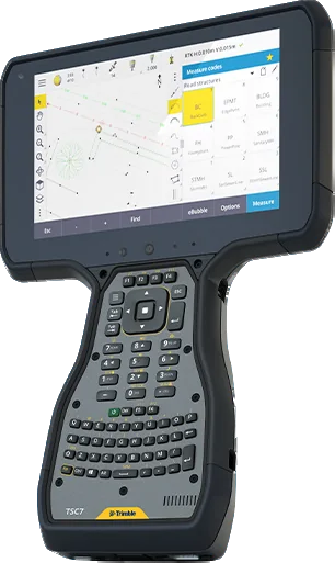
Trimble TSC7, TSC510, TDC6
License
subscription plans available

Ask about licensing and setup

  • License edition and term matched to your needs
  • Invoices for companies
  • Device and system compatibility advice
Brochure in Mongolian (PDF)
  • COGO and coding: powerful COGO routines and one-tap feature coding
  • BIM models: view, review and stake from IFC and TrimBIM files, storing BIM attributes with as-staked points
  • Feature-coded linework: lines and symbols show on the map as you work
  • AutoSync: job data uploads to the cloud automatically at a convenient time
  • TBC parity: control codes match Trimble Business Center for a seamless office workflow
  • Horizontal tilt offset: measure hard-to-reach points; works with underground utility locators
  • Trimble Maps: up-to-date background maps show features near a survey mark
  • Specialized modules: Roads, Rail, Pipelines, Tunnels, Monitoring, Mines and SDK

Brochure in Mongolian

Specifications and features translated into Mongolian, as a PDF.

Talk to a sales engineer

We help you choose equipment and arrange quotes, demo flights, operator training and service.

Request a quote

Leave your number and a sales engineer will call with pricing and training details.

We only use your details to answer this request.