DJI EnterprisePayloads

DJI Zenmuse L2

Product overview

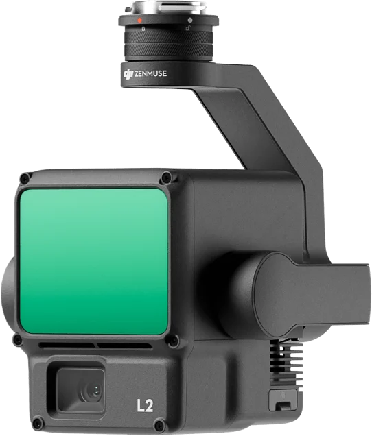
The DJI Zenmuse L2 combines a LiDAR module, a high-accuracy IMU and a 4/3 CMOS RGB mapping camera in one payload for survey and mapping. It reaches 5 cm horizontal and 4 cm vertical accuracy at 150 m and covers 2.5 km² in a single flight. It mounts on the Matrice 400 and Matrice 350 RTK.

Detection range
250 m (10% reflectivity, 100 klx), 450 m (50% reflectivity, 0 klx)
System accuracy (at 150 m)
5 cm horizontal, 4 cm vertical
Point rate
240,000 pts/s (single return), 1,200,000 pts/s (multiple returns)
Returns
up to 5

Made to order, 2–3 weeks

  • 12-month official warranty
  • Invoices for companies
  • Operator training at handover
Brochure in Mongolian (PDF)
  • High accuracy: 5 cm horizontal and 4 cm vertical at 150 m
  • High efficiency: covers 2.5 km² in a single flight
  • Better penetration: smaller laser spots and denser point clouds capture more ground under vegetation
  • Long range: 250 m at 10% reflectivity and up to 450 m at 50%
  • 5 returns: records up to five returns from each laser pulse
  • Point Cloud LiveView: see the point cloud in real time during the flight, colored by reflectivity, height, distance or RGB
  • One-click processing in DJI Terra: export as LAS, PLY, PCD, PNTS or S3MB
  • 4/3 CMOS, 20 MP RGB camera: colorizes the point cloud and captures mapping photos

Brochure in Mongolian

Specifications and features translated into Mongolian, as a PDF.

Talk to a sales engineer

We help you choose equipment and arrange quotes, demo flights, operator training and service.

Request a quote

Leave your number and a sales engineer will call with pricing and training details.

We only use your details to answer this request.